
- Colours correspond to ratios between the artifical sky
brightness
and the natural sky brightness of:
<0.11 (black), 0.11-0.33 (blue), 0.33-1 (green),
1-3 (yellow),
3-9 (orange), >9 (red)
- These maps are intended to show the
levels of pollution in the atmosphere rather than the stellar
visibility, but the colour code can give an estimate:
Red: approximately one hundredth of stars, or few more, is
visible
over 30
degrees of elevation
Orange: the milky way is invisible or quite difficult to
see by an
average observer in normal clear nights
Yellow: artificial sky brightness equal to the natural so
that the total sky brightness is doubled
Blue: artificial sky brightness over 10%
than the natural brightness which is the definition of "light polluted
sky"
- The maps show the artificial sky brightness at the zenith in clear
nights
in V band.
Finally I want to thank Odilon Ferreira Junior from Brazil for
his
fine
software "GPS TrackMaker" ( www.gpstm.com
), which I used for
creating these maps and all the other station maps before.
Oliver Klös
IOTA-ES
| Beligum, The Netherlands, Germany |  |
| Czech Republic, Slovakia | 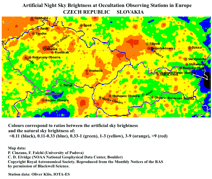 |
| France | 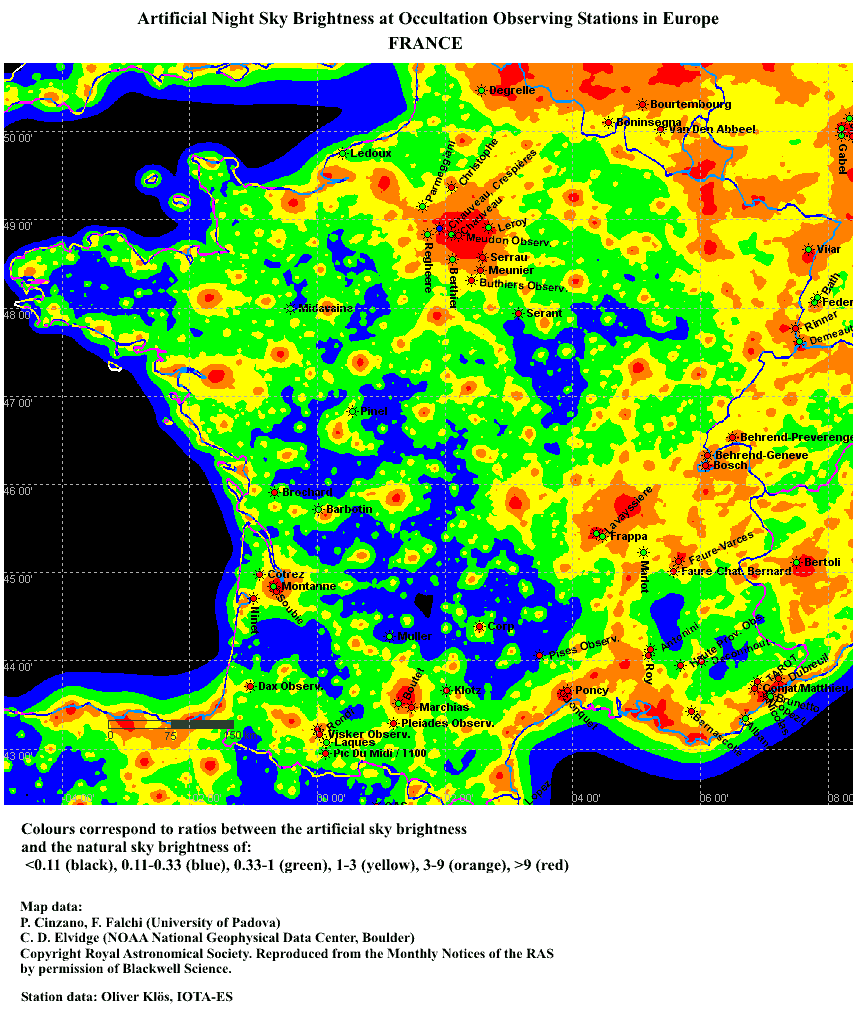 |
| Greece | 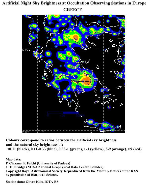 |
| Hungary, Romania | 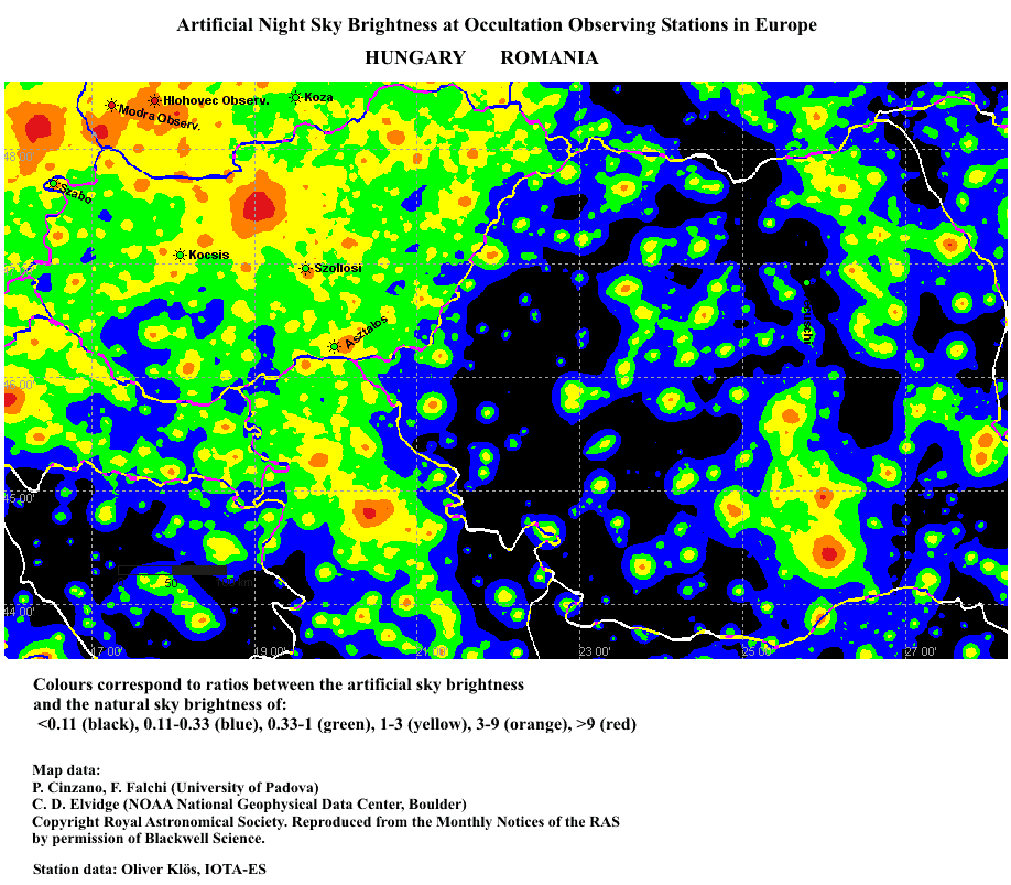 |
| Ireland, U.K. | 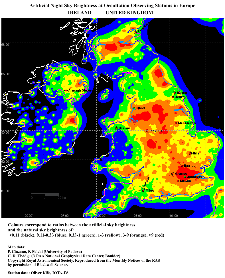 |
| Italy |  |
| Norway, Denmark, Finland |  |
| Poland | 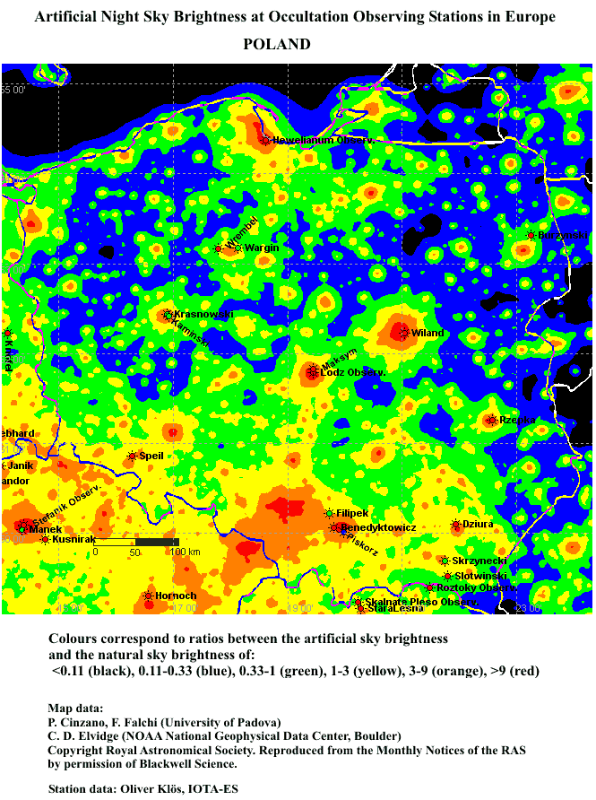 |
| Portugal, Spain | 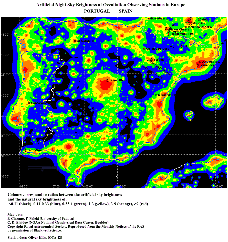 |
| Switzerland, Austria | 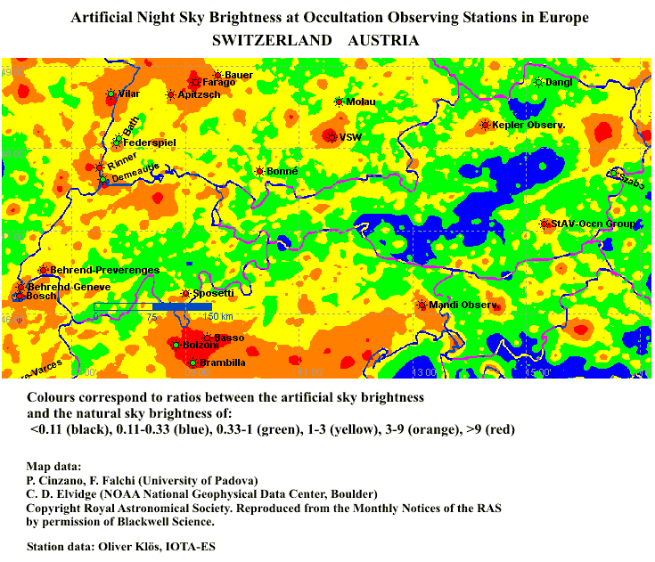 |